Copper Triangle 2010


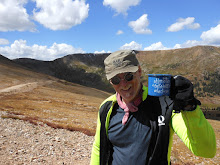
At the first rest stop, just over Fremont Pass.
From the official Copper Triangle website:
The Colorado Cyclist Copper Triangle course is a spectacular 78-mile loop cresting three Colorado Mountain passes - Fremont Pass (elevation 11,318’), Tennessee Pass (elevation 10,424’) and Vail Pass (elevation 10,666’). The course passes three ski areas and is littered with historic mining outposts and Camp Hale, the training ground for the famous 10th Mountain Division. The total elevation gain for the course is 5,981 ft.
The temperature was about 45 degrees as we left the parking lot, at Copper Mountain, and headed immediately up Fremont Pass. The climb up Fremont is not terribly steep, but it is steep enough (and long enough) to warm you up pretty quickly and keep you warm. Carol and I (and 2000 of our closest friends) cranked our ways skyward for over an hour before we got to the first rest stop.
There, I noticed this old TREK 510:


We left the rest stop and bombed down the south side of Fremont Pass at close to 40 mph for a few miles. Eventually, the road flattened out, a bit, and we cruised toward Leadville. There, just on the outskirts of town, we turned onto US 24, and headed toward Tennessee Pass. After another couple of miles of downhill, we leveled out for a while before eventually starting to climb Tennessee Pass. On the climb, we pulled over to peel off a layer, or two, of clothes.

Soon, we arrived at the second rest stop.


Going down Tennessee pass, on the west side of the divide, is a hoot: Ten miles of curvy downhill, with beautiful views to your left, and forest to the right.
Eventually, though, the road turns upward again and you head up Battle Mountain. While the climb is gradual, it's fairly long. But, it's nothing like climbing it from the other side, We did that climb, one year, on this ride and I will never do it again.
But, the good thing about going in the clockwise direction (like we did this year) is that you get to blast down Battle Mountain for 5 miles, or so, into Minturn. From there, it's only a couple of miles to the bike path which parallels I 70 and takes you into the west side of Vail, and to the third rest stop.
After a good rest stop, where we drank lots of water and ate peanut butter and banana bagels, we got back on the bikes and headed east through Vail. The next rest stop is only about eight miles away, on the east side of Vail, but they have it there because that is where you hit the bike path which turns sharply up and takes you over Vail Pass.


Soon after taking off from the flower show, we hit the steepest part of the Vail Pass Trail, the infamous "Wall". The grade increases to around 20%, briefly, and then gets a bit less steep as the trail follows alongside I 70.

Eventually, we made our way into the fourth rest stop, located at the Interstate rest area at the top of Vail Pass. There, we had a brownie, drank some water and then bundled up for the 5 or 6 mile descent back to the ski area at Copper Mountain.
Once down, we parked our bikes and went to eat the dinner provided by the event. As we walked out to the patio tables to eat our lasagna and Ceasar Salad, I heard someone calling my name.

We got back to the house at about 8:00 PM, 16 hours after we left. It was a long, fun day.
Look here for the ride map and elevation profile of the Copper Triangle.
x
posted by Jon @ 2:30 PM
![]()

5 Comments:
The thought of over a mile in elevation change is mind numbing to me. This is probably because I can't do a 40' elevation change without swearing that I'd have to walk the bike...
Wow! I am jealous that looks like a great ride.
awessssssssome!! what early start :D
looks like good times, good company +great views
xxo.meli
Wow, looks like an incredible ride! Those are some HUGE climbs. Way to go.
Looks like a fun ride (for folks who love a climb that is :-))
Post a Comment
Subscribe to Post Comments [Atom]
<< Home